Fortaleza Wetlands Park Network
Nature-based linear park turning a floodplain dump into climate-resilient public space
Status
City description
Fortaleza is Brazil’s 4th largest city, with about 2.57 million inhabitants and nearly 4 million in the metropolitan area. Located on the semi-arid northeast coast, the city faces high climate vulnerability, with intense rainy seasons, localised flooding and heat, combined with rapid, often unplanned urbanisation.
Decades of informal occupation of riparian zones and environmental protection areas, combined with insufficient drainage and green space, have increased exposure of poorer communities along waterways to flooding, pollution and heat stress. The city has responded with a Local Climate Action Plan, vulnerability index and a strong focus on nature-based solutions such as Rachel de Queiroz Park and a growing network of micro-parks.
Challenge
Fortaleza’s west side faced chronic flooding, polluted streams and unsafe vacant land used as illegal dumps and informal sewers. Dense urbanisation had drastically reduced permeable surfaces, overloading drainage systems and leaving vulnerable communities exposed to flood risk, poor water quality and a lack of safe public space.
Solution
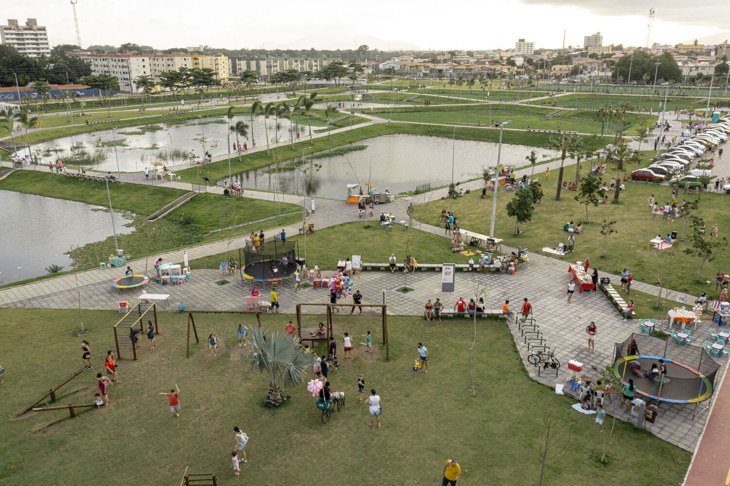
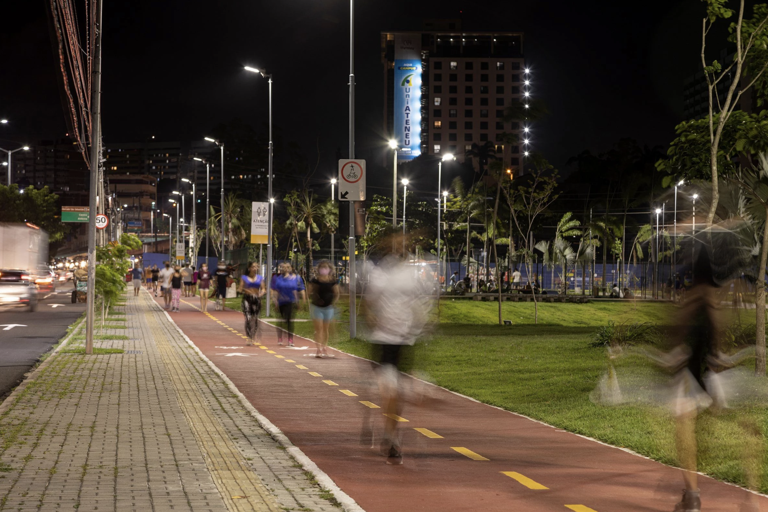
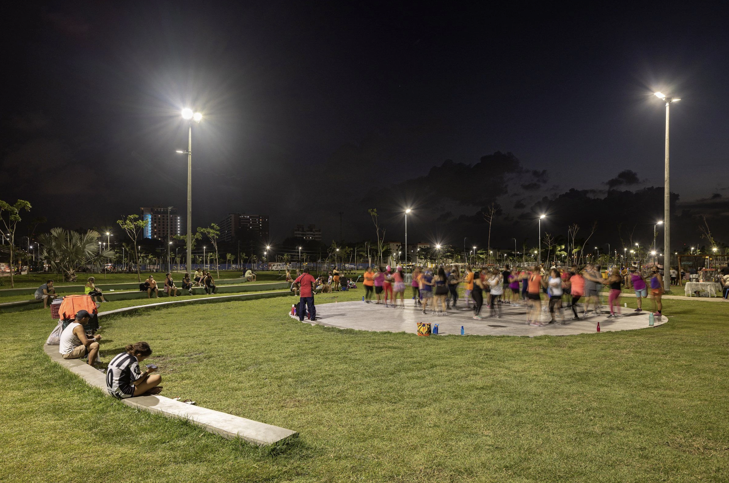
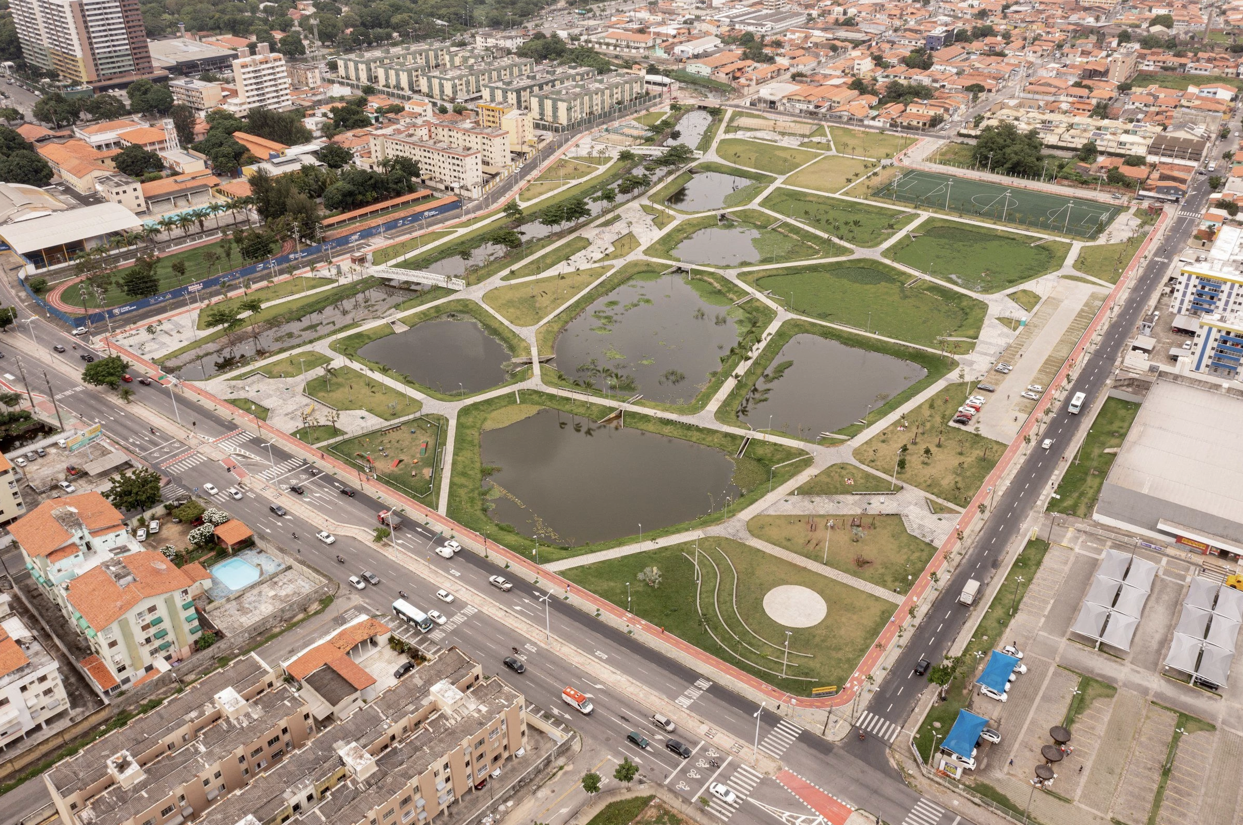
The municipality converted a large degraded floodplain into a wetlands-based linear park. Nine interconnected lagoons now act as natural treatment and retention basins, paired with extensive planting, permeable surfaces, lighting, footbridges and community facilities. The project simultaneously manages stormwater, restores ecosystems, improves mobility and creates inclusive public spaces anchored in nature-based design.
Key Impacts
325,666 m² multifunctional park
turned from from degraded, flood-prone land
9 interconnected artificial lagoons
treating stream and rainwater, improving water quality and providing flood-buffer capacity
1,000 trees and extensive native vegetation planted
supporting biodiversity, urban cooling and habitat restoration.
70,000 people benefiting
from reduced flood risk, improved public space, active-mobility options and cultural activities in the park’s completed sectors
500 direct and indirect jobs created
and 355 local business owners now operating around the park, stimulating neighbourhood economies.
20% increase in nearby property values
reflecting improved environmental quality and public realm, while highlighting the need for proactive social safeguards against displacement.
Awards
- ArchDaily Building of the Year 2023
- nomination for the Loop Design Awards
Comments ()