3D Dublin: Local Digital Twins for Better Decisions
Local digital twins turn data into participatory, climate-smart governance
Status
City description
Dublin is Ireland’s capital and largest city, covering around 115 km² within the Dublin City Council area and over 300 km² in its wider urban footprint. The city council area hosts roughly 590,000 residents, with around 1.46 million in County Dublin and over 2.1 million in the Greater Dublin Area, around 40% of Ireland’s population. Dublin faces intertwined challenges of rapid growth, housing pressure, transport congestion, air pollution hotspots and climate risks, and is implementing the Climate Neutral Dublin 2030 agenda through its Climate Action Plan 2024–2029. Dublin City Council has also launched its Digital Transformation Strategy 2025-2029 to get better with data and empower its people with the tools they need to do the job.
Challenge
Rapid urban change and climate commitments mean Dublin needs tools that can integrate complex data, test scenarios and communicate options clearly to both decision-makers and residents. Traditional maps, reports and consultations are not enough to deal with issues like air quality, resilient housing, flood risk, tourism pressure or emergency preparedness.
Solution
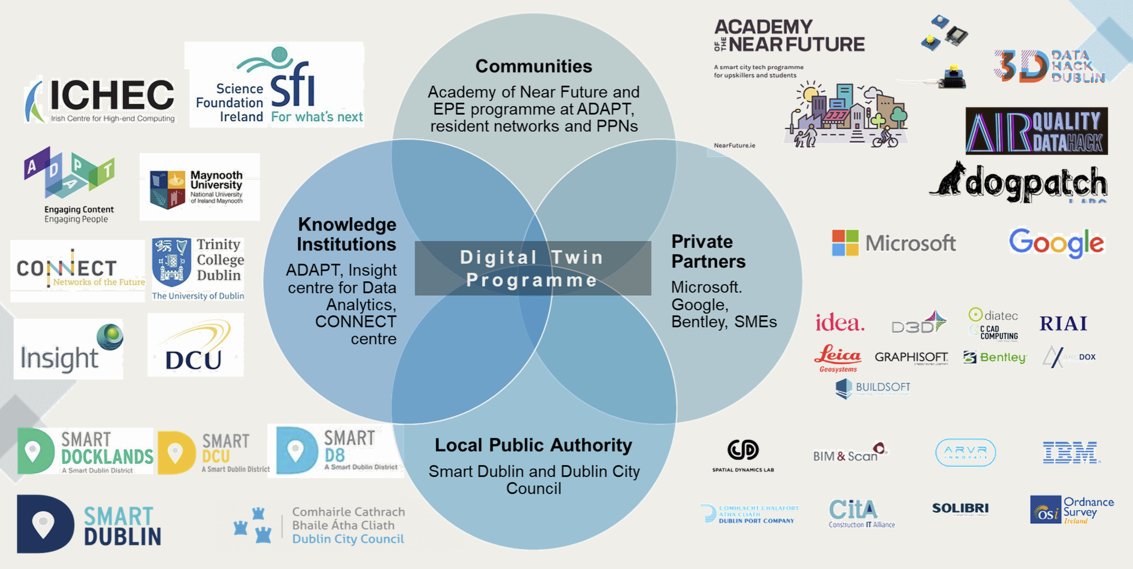
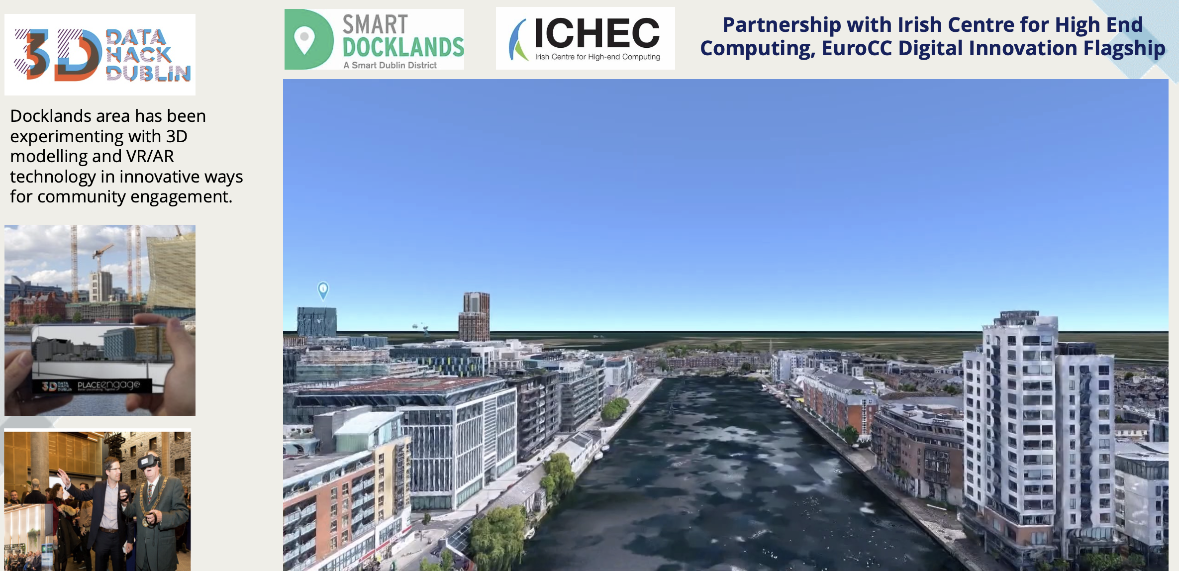
The city’s response is to develop a Local Digital Twins portfolio: high-resolution 3D models and data platforms that connect reality capture, open data, real-time sensors and simulations. These twins support climate action, emergency planning, mobility, heritage conservation and citizen engagement, while deliberately embedding ethics, inclusion and public trust into their design.
Key Impacts
50+ million air quality measurements
collected through Project Air View
45,000+ road segments mapped
with hyperlocal PM2.5 and NO₂ data.
16 months of continuous monitoring
enabling evidence for low-emission and street-design policies
2500+ citizen targeted events
with live public demonstrations of interactive digital platforms and VR headsets
200+ digital twin interest group stakeholders
engaged including local authority staff
300 trainers and 138 organisations
to be engaged through Twin4Resilience communities of practice
7 capacity-building and awareness sessions
for local authority staff and urban planning professionals.
4 formal training and guest lecture sessions
engaging 165+ participants including town planners and masters’ students.
7 national events and 8 international events
reaching 430+ professionals and engaging 2,450+ global participants.
Comments ()